NZRPG - Selling the view
TL;DR
The New Zealand Retail Property Group (NZRPG) had the unenviable task of selling high rise apartments in a block that had yet to be built. Using graphic renders to show the architect’s vision for the interiors is common place, but combining these with the very view the apartment’s new owners would get is something particularly special. One of our most time consuming and testing projects due to the levels of accuracy required, the assets we supplied have been invaluable for site planning and sales well before the ground had been broken.
Below is a small sample of the thousands of panoramic images that were supplied. If you’re looking to gain clarity on your site planning or check elevations, make use of our drone technology to do so. Call Chris on +64 224 261 187 or get in touch via the contact form.
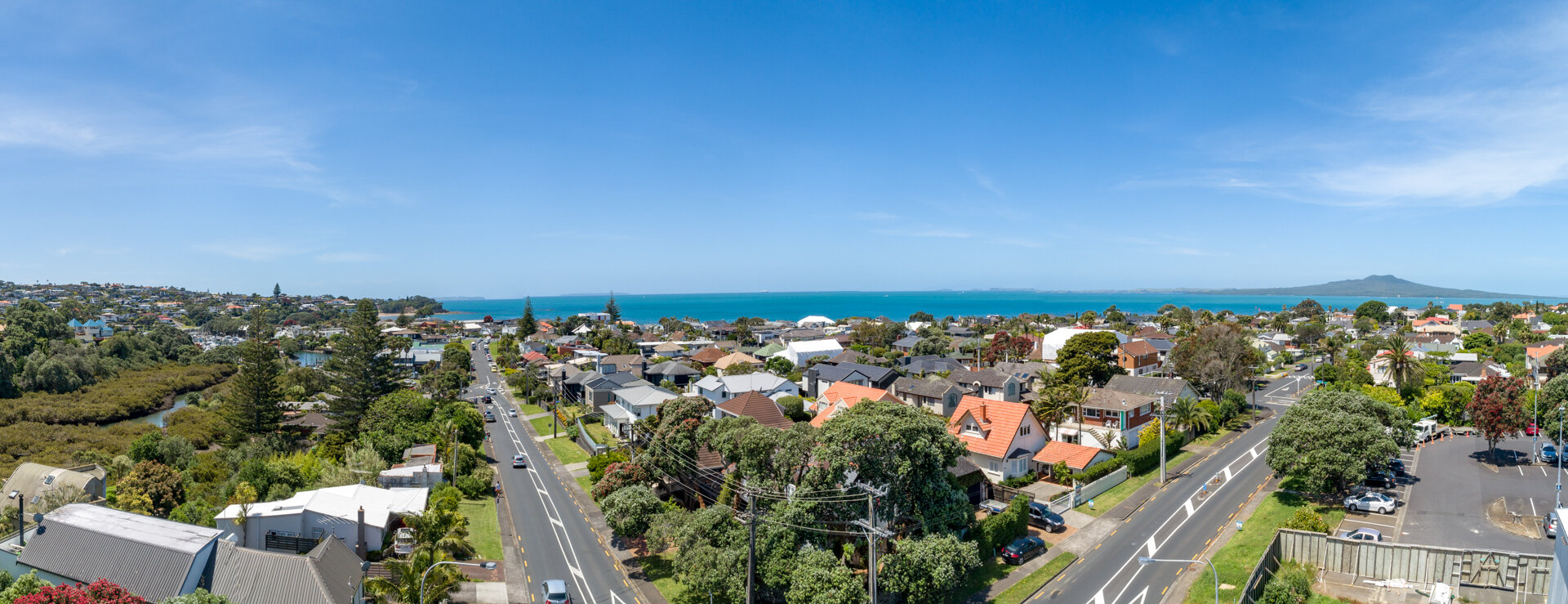
Altitude: 30M. Looking East.
The Client
NZRPG is one of New Zealand’s largest privately owned retail development, investment and management property companies. Proudly New Zealand owned and operated, they have over 20 years experience in the development and management of shopping centres in Auckland and in Tauranga. Check them out at www.nzrpg.co.nz.
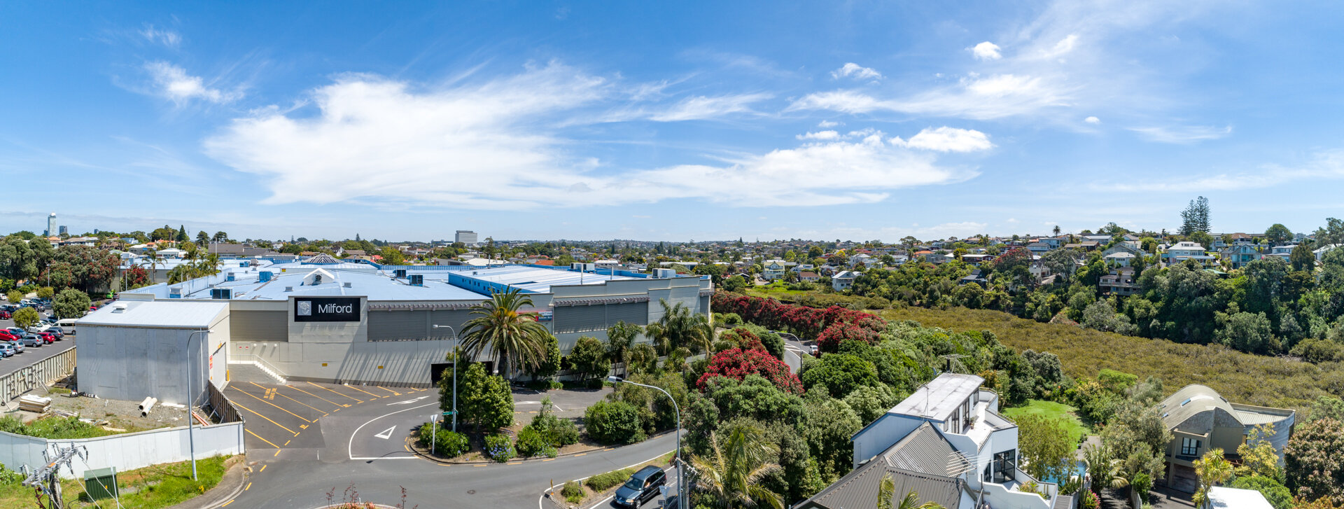
Altitude: 17m. Looking West.
The Story
Ngaere Duff, Senior Project Design Manager at NZRPG, was in urgent need of drone photography to use for marketing their latest development in Milford, Auckland. We managed to squeeze an initial meet and greet onsite just prior to Christmas 2018 where Ngaere took me through the two stages to the project, walked me through the pre-construction site and shared previous examples as references. All extremely helpful to understand the full picture.
Stage one was the urgent part. Ngaere needed a small series of images for materials that were going to market in the next week. These images were needed to show what the views would be from the middle and top floors of the apartment complex and also capture the site prior to construction. The next fine day we went out, captured and supplied these to meet the deadline.
Stage two was far more involved and planning intensive. The team at NZRPG were planning on using the latest in Virtual Reality (VR) technology to give potential buyers an immersive and interactive experience of what it was like to be an owner of an apartment within this development. As a technology obsessed adult (i.e. a bit of a geek) I was immediately hooked and consulted with their IT team on exactly what was required to make sure we could deliver and maintain the highest standards for the experience.

Render from Omana North combined with our drone photography
After discussion back and forth, it was clear we were being tasked with capturing and stitching panoramic images of the views from nearly all the windows in the building. So a 9 storey building, with 7 apartments per storey, many of which had multiple vantage points to take in the views, we were looking at a staggering 129 panoramas. 129!!
After double checking that figure a few times I set to identifying and working through the difficulties that would present themselves. These included, but were not limited to, the sheer time it would take, how to ensure accuracy, the changing weather conditions during that time, battery life, flight permissions next to North Shore hospital, arranging a spotter/battery runner. Not to mention the inevitable dive bombing birds as we were close to the ocean.
Ensuring both accuracy and usability of the eventual outputs were my key concerns. To provide the most accurate images we could we knew we couldn’t rely on GPS and instead use an ingenious low-fi method. We worked with the engineers to mark 20 locations on the ground to represent where the main windows would be in the finished building. We treated each mark as if it were a column extending to the sky and used the drone’s internal barometer to measure the altitude from the takeoff location.

Top floor views
Thankfully DJI drones, such as those we use, have a number of panorama modes built in. We assessed and trialed which would work best for this project alongside NZRPG’s IT team, so were comfortable with the output prior to the shoot. Post shoot we carried out a lengthy post-production cycle of grading each individual image as well as each stitched panorama.
All in all we provided thousands of images, all high quality, all as accurate as our technology would allow and the end result is incredible. You’ll have to head down to the Omana North marketing suite once it opens to check it out for yourself but it’s very impressive and we’re delighted to have been involved in such an innovative project.